At Barry E. Sakal Land Surveying, we promise you customer service that is among the best in the industry. Our mission is to provide land survey results of the highest quality, using the latest and most accurate technologies.
Our results will stand up in court, and we are experienced in a wide variety of survey types. You will be well taken care of, with good communication, dependable results, and a firm quote.
Contact Barry E. Sakal Land Surveying today to learn more.
Land Survey Options
- Mortgage Surveys. This is the land survey your bank requires for a loan. The main goal of the survey is to demonstrate that your house, garage, and driveway are on the property specified.
- Residential Land Surveys. This is a typical lot survey, useful for placing a fence around your property, to proceed with an addition, landscaping, or to remove a tree.
- ALTA (American Land Title) Surveys. ALTA represents the Cadillac of surveys. Every detail affecting property use is covered, including such items as electric and gas lines, sidewalks, paths, and more. Our use of GPS systems allows us to provide such surveys in a timely manner and at a fair price.
- Farmland Surveys. GPS systems allow us to perform a typical farmland survey in a quarter the time required using conventional equipment, with greater accuracy.
- Woodland Surveys. Large acreage woodland surveys are one of our specialties. Our experience with a large number of woodland surveys over twenty years makes us one of the most efficient land surveyors in this area. Points that may have taken days to find in the past can be quickly located using the latest GPS systems.
- Subdivisions. The subdivision process can be daunting, with a large amount of paperwork and regulation. At Barry E. Sakal Land Surveying, we have the process well in hand. Our investments in top-of-the-line technologies allow us to prepare the paperwork quickly and accurately. We communicate with planning departments to make certain your subdivision plan complies with all applicable rules. If necessary, we will attend any meetings with you, to make certain things proceed smoothly.
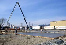
- Construction Stakeout. GPS systems allow us to perform construction stakeout faster and more accurately than ever before. Work that may have taken a day or more using conventional equipment can be completed in hours.
- Topographical Surveys. Using orthometric aerial photographs and referencing U.S. Geological survey topo maps, along with traditional "boots on the ground" survey analysis, we can quickly prepare topographical surveys at a reasonable price.
- Elevation Certificates. Our experience includes filling out FEMA elevation certificates. Our GPS systems experience provides solid elevation results.
- Boundary Disputes. At Barry E. Sakal Land Surveying, we are known for thoroughness, accuracy, extensive research, and accurate field work. With an educational background at Penn State in Boundary Law, Barry E. Sakal is ready to defend our land survey results in a court of law.
Contact Us today to learn how Barry E. Sakal Land Surveying can be of service to you.
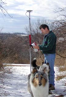
GPS Systems
Our surveying services rely on a foundation of extensive research and precise groundwork, but also on modern GPS systems (Global Positioning) and Geographic Information Systems. As an early adopter of these technologies, we have found we are able to provide a more thorough and accurate survey at a better price.
Land Survey Timelines
Small residential surveys are usually completed within 1 to 2 weeks. Larger, commercial land surveys may take from 30 to 60 days, depending on the needs of the survey.
We are willing to consider expediting land surveys needed on a priority or "emergency" basis.
Service Area
Barry E. Sakal Land Surveying provides accurate land survey results for both commercial and residential clients throughout Southwestern PA, including the Pittsburgh region and the communities of Beaver, Blairsville, Connellsville, Cranberry, Ebensburg, Greensburg, Irwin, Kittanning, Latrobe, Ligonier, Mt Pleasant, Murrysville, North Huntingdon, Ohiopyle, Seven Springs, Tionesta, Uniontown, Waynesburg and more.
We have served clients in the counties of Allegheny, Armstrong, Beaver, Butler, Cambria, Clarion, Fayette, Forest, Greene, Indiana, Somerset, Washington, and Westmoreland. Our services have been required as far a field as Gettysburg, so please don't hesitate to contact Sakal Land Surveying for your land surveying needs.
Surveying Services Clients
At Barry E. Sakal Land Surveying, our clients range from the neighbor next door to large land concerns, industrial clients, and area agencies, such as:
- Western Pennsylvania Conservancy
- Westmoreland County Industrial Development Corporation
- Municipal Authority of Westmoreland County
We have significant experience working with farms, forestry agencies, and in the timber/logging industry.
Contact Us today to learn how we can meet your land survey needs.